There is a place on Madeira where you can stand on a narrow mountain pass and see both coasts of the island at the same time — the deep blue Atlantic to the south and the wild, cloud-wrapped northern shore to your left. That place is Encumeada, and the trail that takes you there is one of the most rewarding mountain walks in all of Portugal.
Trail Overview
| Detail | Info | |---|---| | Trail name | Vereda da Encumeada (PR1.3) | | Location | Central mountain ridge, Serra de Água / São Vicente | | Start/End | Boca da Encumeada (ER228 road pass) | | Altitude | ~1,007 m at the pass | | Distance | ~11 km (varies by route option) | | Duration | 4–5 hours | | Trail markings | Yellow and red PR waymarks |
The Vereda da Encumeada follows the central spine of Madeira, connecting the Encumeada pass with sections of the island's highest ridgeline. Unlike the more famous Arieiro–Ruivo route to the east, this trail sees fewer hikers, which means you often have the volcanic crags and laurel-draped valleys entirely to yourself.
The trailhead sits right at the Boca da Encumeada, a well-known mountain pass on the ER228 road between Ribeira Brava (south coast) and São Vicente (north coast). There is a car park, a restaurant, and a small viewpoint terrace — making it easy to access by car or bus.
The Encumeada Pass — 1,007 Metres Above the Sea
Encumeada is not just a trailhead. It is a geographical crossroads. At 1,007 metres, the pass sits in the saddle between two of Madeira's tallest massifs — Pico Ruivo to the east and Paul da Serra to the west. This makes it one of the very few places on the island where the central mountain chain dips low enough to create a natural corridor between the north and south coasts.
On clear days, you can see the town of São Vicente and the ocean to the north, and the valley of Serra de Água dropping away toward the south coast. The contrast is striking: the northern slopes are lush, steep, and often shrouded in cloud, while the southern side is drier and bathed in sunlight.
Arrive early in the morning for the best chance of clear skies at the pass. Cloud tends to build from the north during the afternoon, and by midday the northern views can disappear behind a wall of mist.
Views of Both Coasts
This is the defining feature of the Encumeada trail — and something very few hikes in Europe can offer. As you walk the ridgeline, you are constantly switching between views of the two sides of the island:
- South coast: The terraced hillsides of Serra de Água, the Ribeira Brava valley, and the sun-drenched southern shoreline stretching toward Funchal.
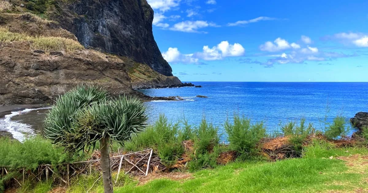
- North coast: The dramatic green gorges of São Vicente, the cloud forests clinging to the slopes, and the dark basalt cliffs that meet the ocean far below.
At several points along the trail, you can see both coasts simultaneously. This dual perspective gives you a rare understanding of how narrow and steep Madeira truly is — a volcanic island only 22 km wide at its broadest point, yet rising to nearly 1,900 metres.
The ridgeline sections are exposed and can be windy, but they reward you with panoramic views in every direction. On exceptionally clear days, you can spot the Desertas Islands to the southeast and the faint outline of Porto Santo to the northeast.
Difficulty
The Vereda da Encumeada is rated moderate to challenging. It is not as demanding as the Pico do Arieiro to Pico Ruivo traverse, but it should not be underestimated.
What Makes It Challenging
- Elevation changes: The trail follows the ridge with constant ups and downs. Total elevation gain over the full route is approximately 500–600 metres.
- Exposed sections: Parts of the path run along narrow ridgelines with steep drop-offs. Railings are installed at the most exposed points, but hikers who are uncomfortable with heights should be aware.
- Uneven terrain: The volcanic rock surface is rough and can be slippery when wet. Proper hiking boots with good grip are essential.
- Weather shifts: Conditions at 1,000 metres can change rapidly. Cloud, wind, and rain can roll in within minutes, even on days that start clear.
What Makes It Accessible
- Well-marked trail: The PR waymarks are clear and consistent throughout.
- Moderate distance: At around 11 km, the trail is manageable for reasonably fit hikers.
- Easy trailhead access: The Encumeada pass is on a main road, with parking and facilities.
- No tunnels: Unlike the Arieiro–Ruivo route, there are no dark tunnels to navigate.
Always check trail conditions on the IFCN Madeira website or app before setting out. Mountain trails can be closed due to rockfall, fire risk, or extreme weather.
Best Season
The trail is open year-round, but the experience varies considerably depending on when you go:
- May to October is the best period. Skies are clearest, temperatures at altitude are comfortable (15–22 °C), and daylight hours are long. July and August are the driest months, but can be hot on the exposed ridgeline — bring plenty of water and sun protection.
- September and early October offer the sweet spot: warm weather, fewer crowds than peak summer, and excellent visibility. The autumn light at this altitude is particularly beautiful.
- November to March brings rain, fog, and cooler temperatures. The trail can be slippery, and cloud often obscures the views that make this hike special. However, rare clear winter days deliver the most dramatic cloud inversions and lighting.
- April is transitional — wildflowers begin to bloom on the slopes, but rain is still possible.
What to Bring
- Hiking boots with ankle support and solid grip — the volcanic rock is unforgiving.
- Windproof jacket — the ridgeline is exposed, and wind at 1,000 m can be strong even in summer.
- Warm layer — a fleece or insulated mid-layer, as temperatures drop significantly compared to sea level.
- Sun protection — hat, sunglasses, and sunscreen. UV exposure at altitude is intense.
- At least 1.5 litres of water per person and energy-rich snacks.
- Rain jacket — mountain weather is unpredictable.
- Fully charged phone — for navigation and emergencies. Mobile signal is intermittent along the ridge.
Getting There
By Car
The Boca da Encumeada is approximately 40 minutes from Funchal by car. Take the Via Rápida (VR1) west to Ribeira Brava, then follow the ER228 north through the Serra de Água valley. The road climbs steadily through terraced farmland and eucalyptus forest before reaching the pass. There is a free car park at the trailhead.
From the north coast, the pass is about 20 minutes from São Vicente on the same ER228 road.
By Bus
Rodoeste bus line 6 (Funchal–São Vicente) passes through the Encumeada pass. Check the current timetable, as services are limited — typically a few departures per day. This makes it possible to hike one-way and catch a bus back, but plan carefully around the schedule.
Combine with a Zipline
After a day traversing Madeira's mountain spine, there is no better way to follow up than with a rush of pure adrenaline. The zipline at Adrenaline Adventures in Porto Moniz lets you soar 1.6 km over a stunning valley at speeds up to 110 km/h, with the Atlantic Ocean as your backdrop.
The drive from the Encumeada pass to Porto Moniz takes about 40 minutes along the scenic north coast road through São Vicente — one of the most beautiful drives on the island. You can easily combine the hike one day and the zipline the next for an unforgettable two-day mountain-and-ocean adventure.
Or, if you prefer to keep things in one day, do the zipline in the morning and hike the Encumeada in the afternoon (or vice versa). The proximity of the trailhead to Porto Moniz makes this pairing uniquely convenient.
View Zipline Prices and BookThe Vereda da Encumeada gives you something rare — a trail where the entire island reveals itself from a single ridgeline. Two coasts, two climates, one unforgettable walk through the heart of Madeira.
Frequently Asked Questions
Are levada walks dangerous?
Most levada walks are safe and well-maintained. Some trails have narrow sections and tunnels — bring a torch and wear proper hiking shoes.
Do I need a guide for hiking in Madeira?
Well-marked PR trails can be done self-guided. For challenging routes like Pico Arieiro to Pico Ruivo, a guide adds safety and local knowledge.
What should I bring on a levada walk?
Waterproof jacket, hiking boots, water (1.5L minimum), snacks, headtorch for tunnels, and sun protection.
When is the best season for hiking?
April to June and September to October offer the best conditions — mild temperatures, less rain, and fewer crowds.
Read Also
- Best Hikes and Levadas in Madeira — The top trails on the island, from mountain ridges to canal-side walks through laurel forest.
- Pico do Arieiro to Pico Ruivo — Madeira's Most Iconic Hike — Everything you need to know about the PR1, the island's most famous mountain traverse.
- Best Viewpoints in Madeira — The most spectacular miradouros across the island, including dual-coast panoramas.